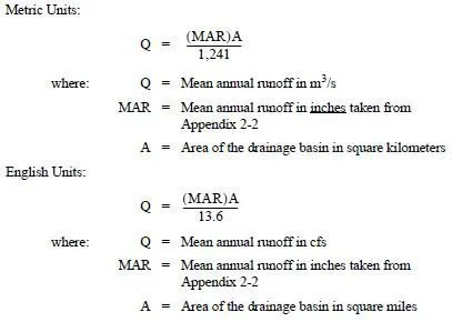
MGSFlood should be used once the PEO has selected the BMP(s) for the project site and has determined the input values for precipitation, delineated drainage basin areas, and soil characteristics. Each of these input values is further described in the sections below.
2-8.1.1 Precipitation Input
Two methods for transposing precipitation time series are available in the continuous-simulation model: extended precipitation time series selection and precipitation station selection. The PEO will generally select the extended precipitation time series unless it is not available for a project site; then the precipitation station is selected. Both methods are further described below:
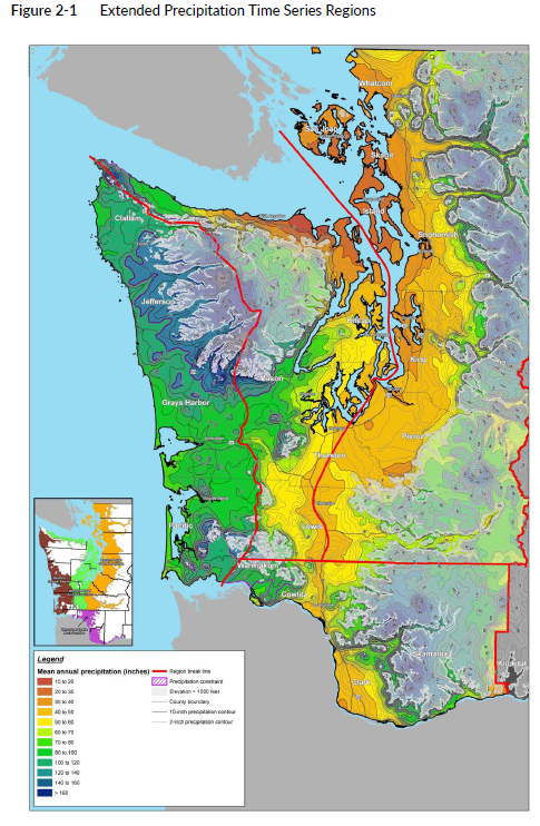
Extended precipitation time series selection: Uses a family of prescaled precipitation and evaporation time series (). These time series were developed by combining and scaling precipitation records from widely separated stations, resulting in record lengths in excess of 100 years. Extended hourly precipitation and evaporation time series have been developed using this method for most of the lowland areas of western Washington where WSDOT projects are constructed. These time series should be used for stormwater facility design for project sites.
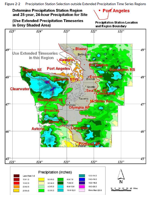
Precipitation station selection: For project sites located outside the extended time series region, a second precipitation scaling method is used (). A source gage is selected, and a single scaling factor is applied to transpose the hourly record from the source gage to the site of interest (target site). The current approach for single-factor scaling, as recommended in Ecology’s Stormwater Management Manual for Western Washington (Ecology 2019), is to compute the scaling factor as the ratio of the 25-year, 24-hour precipitation for the target and source sites. Contact the RHE or State Hydraulics Office staff if assistance is needed in selecting the appropriate gage.
2-8.1.2 Hydrologic Soil Groups
For each basin, land cover is defined in units of acres for predeveloped and developed conditions. Soils must be classified into one of three categories for use in MGSFlood: till, outwash, or saturated soil (as defined by USGS). Mapping of soil types by NRCS is the most common source of soil/geologic information used in hydrologic analyses for stormwater facility design. Each soil type defined by NRCS has been classified into one of four hydrologic soil groups: A, B, C, or D. In western Washington, the soil groups used in MGSFlood generally correspond to the NRCS hydrologic soil groups shown in Table 2-6.

NRCS Type B soils can be classified as either glacial till or outwash, depending on the type of soil under consideration. Type B soils underlain by glacial till or bedrock, or that have a seasonally high water table, are classified as till. Conversely, well-drained Type B soils should be classified as outwash. It is important to work with the HQ Materials Laboratory or a licensed geotechnical engineer to confirm that the soil properties and near-surface hydrogeology of the site are well understood, as they are significant factors in the final modeling results. The Highway Runoff Manual contains some soils classification information for preliminary work.
Wetland soils remain saturated throughout much of the year. The hydrologic response from wetlands is variable, depending on the underlying geology, the proximity of the wetland to the regional groundwater table, and the geometry of the wetland. Generally, wetlands provide some base flow to streams in the summer months and attenuate storm flows via temporary storage and slow release in the winter. Special design consideration must be given when including wetlands in continuous-simulation runoff modeling.