The SBUH Method requires the input of a rainfall distribution or a design storm hyetograph. The design storm hyetograph is rainfall depth versus time for a given design storm frequency and duration. For this application, it is presented as a dimensionless table of unit rainfall depth (incremental rainfall depth for each time interval divided by the total rainfall depth) versus time. The type of design storm used depends on the project locations as noted below:
• Eastern Washington: For projects in eastern Washington, the design storms are usually the short-duration storm for conveyance design and the regional storm for volume-based stormwater facilities. (Design storms are discussed further in the Highway Runoff Manual.) However, occasionally with large basins and long concentration periods, the long duration regional (or Type 1A) storm will produce larger flow (Qs). Western Washington: For projects in western Washington, the design storm for conveyance is the Type 1A storm. For designs other than conveyance, see Section
2-8 for a description of the Continuous-Simulation Method.
Along with the design storm, precipitation depths are needed and shall be selected for the city nearest to the project site using 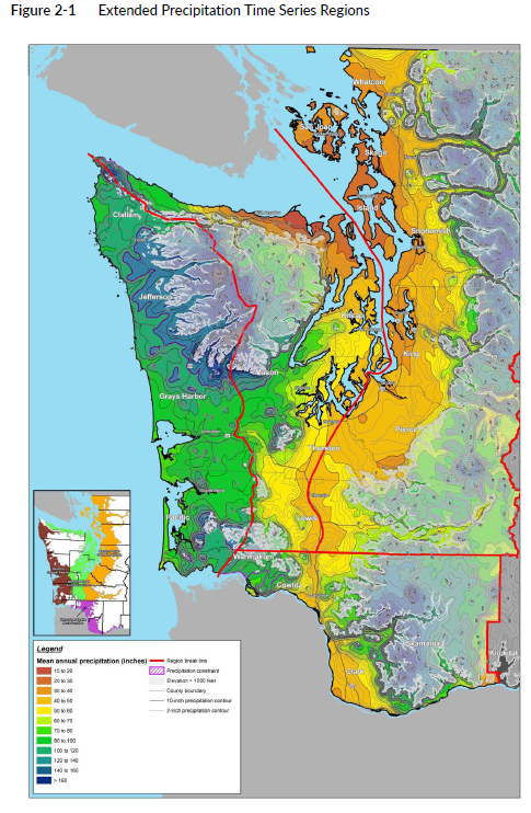 PRISM data available from ArcGIS Workbench as the primary data source for the most accurate results from its interpolation methodology, followed by using an isopluvial map that clearly identifies the location within the map contours (see Figure 2-1).