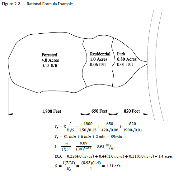
Compute the 25-year runoff for the Spokane watershed shown in Figure 2-3. Three types of flow conditions exist from the highest point in the watershed to the outlet. The upper portion is 4.0 acres of forest cover with an average slope of 0.15 foot vertical per 1 foot horizontal (ft/ft). The middle portion is 1.0 acre of single-family residential with a slope of 0.06 ft/ft and primarily lawns. The lower portion is a 0.8-acre park with 18-inch-diameter storm sewers with a general slope of 0.01 ft/ft.
Appendices
Appendix 2A Isopluvial and MAP Web Links and Mean Annual Precipitation Data
The 24-hour and 2-hour isopluvial maps and mean annual precipitation maps for Washington are available in PDF format on WSDOT’s hydraulics and hydrology webpage under tools, templates, and links or by using GIS Workbench. Contact your local GIS group for how to extract digital precipitation data using ArcMap.
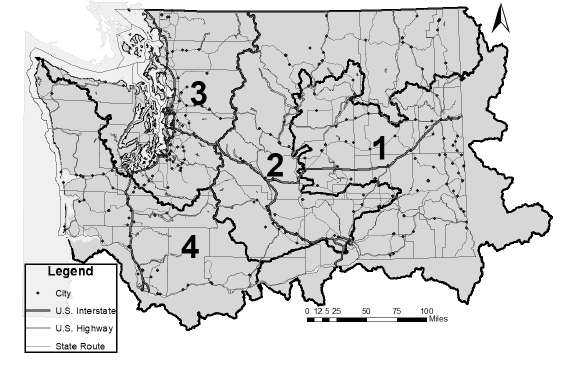
Appendix 2B USGS Regression Equation Zone Map


